Here are today’s answers.
Today’s questions are about geography from down under to the roof of the world.
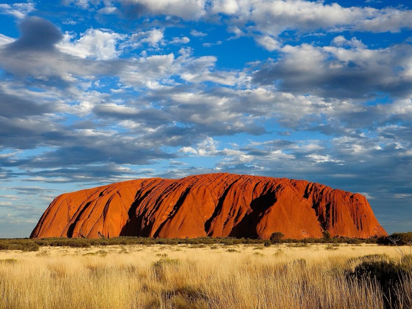
Image Wikipedia
One
The massive sandstone monolith pictured above is sacred to the Aṉangu people. Could you tell me its name and the state or territory it’s located in?
A: Uluru/Ayers Rock; Northern Territory
Uluru/Ayers Rock, sighted in 1873 and named after Sir Henry Ayers, was renamed Uluru/Ayers Rock in 1993, reflecting its traditional Pitjantjatjara name which has been in use for thousands of years. The monolith, which appears to change colour dramatically at sunrise and sunset, is 348 metres (1,142 feet) high.
Two
What is the largest island in the United States of America?
Answer: Hawaiʻi
Also known as the Big Island, Hawaiʻi is 4,028 square miles (10,433 km2) in area. The next island in size is Kodiak Island, with an area of 3,588 square miles (9,292 km2).
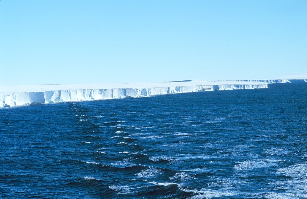
Image Wikipedia
Three
What is the name of the world’s largest ice shelf, located along the coast of Antarctica?
Answer: The Ross Ice Shelf
The Ross Ice Shelf covers an area roughly the size of France, and its floating ice can be up to 750 metres (2,460 feet) thick.
Four
The Danube River flows through more countries than any other river in the world. How many countries does it pass through or border?
Answer: Ten
The Danube flows through or borders ten countries — Germany, Austria, Slovakia, Hungary, Croatia, Serbia, Bulgaria, Romania, Moldova and Ukraine — before emptying into the Black Sea.
Five
Mount Everest sits on the border between Nepal and which autonomous region?
Answer: Tibet Autonomous Region
Tibet, since 1951 an autonomous region of China, the highest region on Earth, has an average elevation of 4,380 metres (14,000 feet). Its peak, Mount Everest, stands at 8,848.86 metres (29,031 feet) above sea level, making it Earth’s highest point.

Leave a comment